
Always Looking for Roads In
One thing about hiking with CMT: you have to do a long hike in short bursts. That means I’m always scanning maps for back roads that touch the trail.
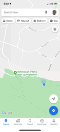
According to Google Maps, our future path would touch city streets at Mora Road and, another mile along, Ravensbury Road (a name which I’ll totally put into a fantasy story some day). Last week from the water tank I’d seen the gate at Mora Road. Today Geri and I planned a loop: park near Mora Gate, hike to Ravensbury and then come back to our car along city streets.
There was no chance the local residents would allow parking at the trailhead but we checked it out just in case. Sure enough, No Parking. We made a U-Turn and drove back down, looking for a place where parking was allowed. Mora Road was lined with trees, gardens, mansions, locked rolling security gates and “No Parking 6 am to 8 pm, 7 days a week” signs.
I groused, “I can understand them not wanting cars clogging the road on busy weekends, but weekdays too? Rich white privilege.” Geri nodded. She doesn’t like to encourage me when I start ranting.
Some houses had big flat spaces along the road but the residents had set white stones in them to stop people parking there even between 8 pm and 6 am. “Greedy bastards,” I said. “If I had the money, I’d rent a dozen big trucks and park them all along here with their motors running every night from 8 pm to 6 am.”
“Mmm hmm,” Geri said, smiling, and I said with a wry grin, “Okay, not really.”
Clumping Along Pavement
About three blocks from the trailhead we found a flat place beside the road which was packed with cars and the nearest “No Parking” signs more than a block away. Just to be sure, I pulled out my phone and Googled “Rules for No Parking signs California.” According to a government website, signs apply to their own side of the street and only to an unbroken section of curb unless the sign itself says otherwise.
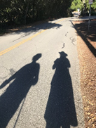
My walking sticks clicked on the pavement. The streets up here were more like fire roads that just happened to be paved and have an occasional car. Pavement is a mixed blessing for me: I’m less likely to slip but my legs drum into aching exhaustion. At last we reached the park gate.
Attainable
Of course, we had to walk the .1 mile in to the water tank where I’d stopped last time so I could “pick up my footsteps.” Geri smiled adoringly. We enjoyed the view but this was still early days of COVID, before vaccination, and when a maskless mother and daughter stationed themselves nearby, we got up and left.
We walked back to Mora gate and then turned left on the Mora Trail. As we walked, I scanned the hills ahead. “See those slender radio towers? Not the electric towers but over to the left? That’s Black Mountain and it’s one of the landmarks we’ll reach. On the other side of that, it’s a quick drop down to Montebello parking lot.”
“That looks attainable,” she smiled.
Loud Voices
Even on a sunny Sunday, this part of Rancho San Antonio was only lightly used. We did pass several people but nothing like the hordes down on the main trails. Anytime a person was in sight we pulled our masks up. Otherwise, we left them hanging around our necks.
For the first time on this entire hike, we started down dirt switchbacks. A real trail, at last!
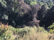
In a little dell, we stepped off the trail, crossed a dry hollow and climbed a hillside until we found a leaf-covered slope under oak and bay trees. I looked hard and didn’t see any poison oak plants or bright red poison oak leaves on the ground. So we plonked down, ready at last for some solitude and quiet, once an approaching group passed.
But they didn’t pass. They stopped to have a long gab session right across from us.
Some families have extra loud voices. This group must have been one extended family because they all had that trait. Every word they said was in an excited bellow or yell. When they finally moved on, we heard them for another five minutes shouting out things to each other as they walked.
But at last, they crossed over the ridge, the sound faded out and we were left with birds and the sunlight through the trees.
The final few tenths of a mile were steep downhill until, right where it should be, we came to the gate to Ravensbury Ave. From there a warm half mile up an almost deserted road beside a white fence and a former farmhouse or two led us back at our car.
Hiking In To Sky Camp
More memories of my first backpack trip with CMT:
How do I always set myself up like this, I thought as I climbed the fire road which was wa-a-a-y steeper and longer than I thought it would be.
See, I’d known it was only a 1.5-mile moderate climb to Sky Camp so I dawdled at home all morning, reading and working math problems. I stopped for a latte on the way out of town. I reached the Visitor’s Center where you had to check in and get your camping permit in the early afternoon. I drove leisurely to the trailhead.
Even at the trailhead, I was nervous about leaving the safety of the car and going out on my own. (It had been like this at the start of every backpack trip I’d ever done, even back when I was stronger.) I sat in the car and ate one of my trail bars and listened to a Feynman lecture. At last I carefully hoisted my pack and set out.
And so it was that when the trail started a relentless climb, I had a deadline that was far closer than it should have been. Get to camp before dark, don’t stop too long, keep going, but I’m tired, I have to rest. I caught glimpses of orange sky and gleaming sun and intense green forest but it was all outside of me as I focused only on not getting caught out by dark again.
I finally reached the top of the ridge and cell phone signal, enough to exchange some love with Geri and to have to stop myself from getting lost in geekery. I still had signal a bit further, enough to say a quick “bye-for-now.” A little further, no more signal. That was good: I badly needed to be on my own. But I was immediately lonely, like I’d always been at the start of any backpacking trip.
The sun was near setting and Sky Camp had to be almost within sight. But the trail dipped, a gravelly downhill, easiest for me to slip on. I focused on my footing until the trail bottomed out and started to climb.
Up the next rise, I saw a cement outhouse. I’d made it.
Through the Trees
I hadn’t been to Sky Camp since the mid-1980s. That was so long ago that the ranger at the registration desk didn’t even know the sites used to be free. (They’re $20/night now but I got half price with my Golden Access pass. One small reward for disability.) Back then the campground was just a cluster of picnic tables on a grassy hillside.
I knew they’d expanded the campground since then because I’d had to look at a map to select my campsite. But I still expected to just walk in and set up camp.
The grassy hillside is now one single campsite and a dozen other sites have been carved out of the surrounding forest, sheltered and private. It’s better in every way than it once was but I was in Site #10 and I soon realized that even with a map I was going to have to search for it.
I found myself walking onto a narrow trail through thick forest in the growing dark and scratching my head at a junction not shown on the campground map. I took the right-hand fork and walked on and on, legs more tired and weak with each step. Yup, this was me again, out in the dark, walking and walking, not sure I was getting anywhere.
But at last I saw a side trail and it had a numbered post which was almost invisible in the dim light. I stopped to strap on my headlamp. (I’d made sure to have the freshest of batteries: I wasn’t going to get caught that way again!). The number 6 was on the post. I’d reached a campsite at last. Let’s see, sites 1 and 2 were on the grassy hillside. The left-hand fork back at the junction must have gone to sites 3-5. Somewhere far up ahead was Site #10. I plodded on, leaning more heavily on my walking sticks.
But the side-paths with the numbered posts came more quickly now. 7, 8 and 9 slid by and at last, blessedly, number 10 just a minute later.
It really was beautiful: secluded, surrounded by tall bushes and trees, emerging stars winking overhead. I set down my pack, took a few minutes to breathe and enjoy the deepening evening, then got ready to go fill my water bottles. The map showed a water spigot back where the bathrooms were.
Oh dear. For a person at full strength that would be a ten-minute round trip; I had to allow twenty. You need about a half-gallon to get one person through one night but I hadn’t thought to bring along an empty half-gallon container. I’d brought three half-liter water bottles.
A half-gallon would take three trips. The water was there and I was here, exhausted and heavy with weak legs that couldn’t possibly face another hour of hiking…